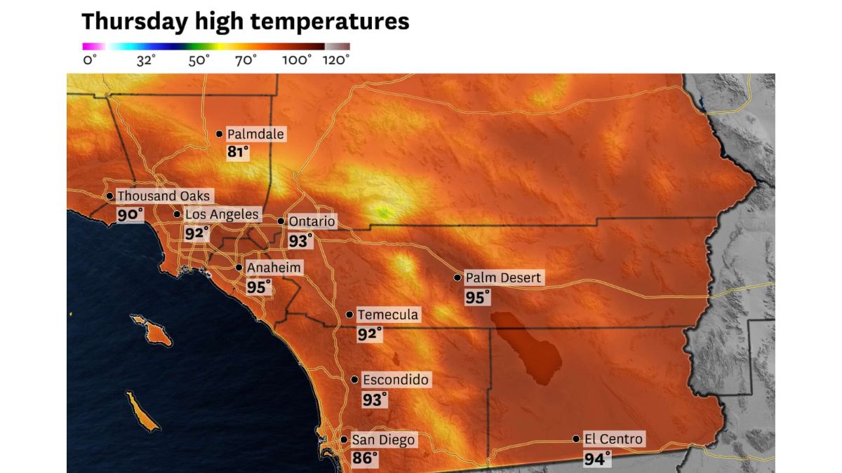
WATERTOWN, N.Y. — A line of powerful thunderstorms tore through Jefferson and Lewis counties Tuesday night, toppling trees, snapping power lines and prompting a string of severe weather warnings from the National Weather Service in Buffalo.
The first warning came at 12:35 p.m. Monday, and NWS Buffalo continued issuing alerts throughout the day and into the night as new cells developed.
By early afternoon, a “destructive storm” was tracked over Glen Park and Watertown, with forecasters warning of wind gusts up to 80 mph and hail the size of quarters. Officials cautioned that flying debris could injure people caught outdoors and that widespread power outages were likely.
The threat continued into the evening. Around 2:31 p.m., a storm near Forestport and Boonville produced 70 mph gusts.
Then, starting at 10:42 p.m., a fresh round of severe thunderstorms moved into northeastern Jefferson and north central Lewis counties, bringing 60 mph winds and penny-size hail, along with the risk of tornadoes and flash flooding.
A follow-up warning issued at 11:30 p.m. extended the threat until 12:30 a.m. Tuesday, as the storm line pushed southeast at 35 mph through communities including Watertown, Fort Drum, Carthage, Lowville and Adams Center. A stretch of I-81 between exits 43 and 47 was also in the warning area.
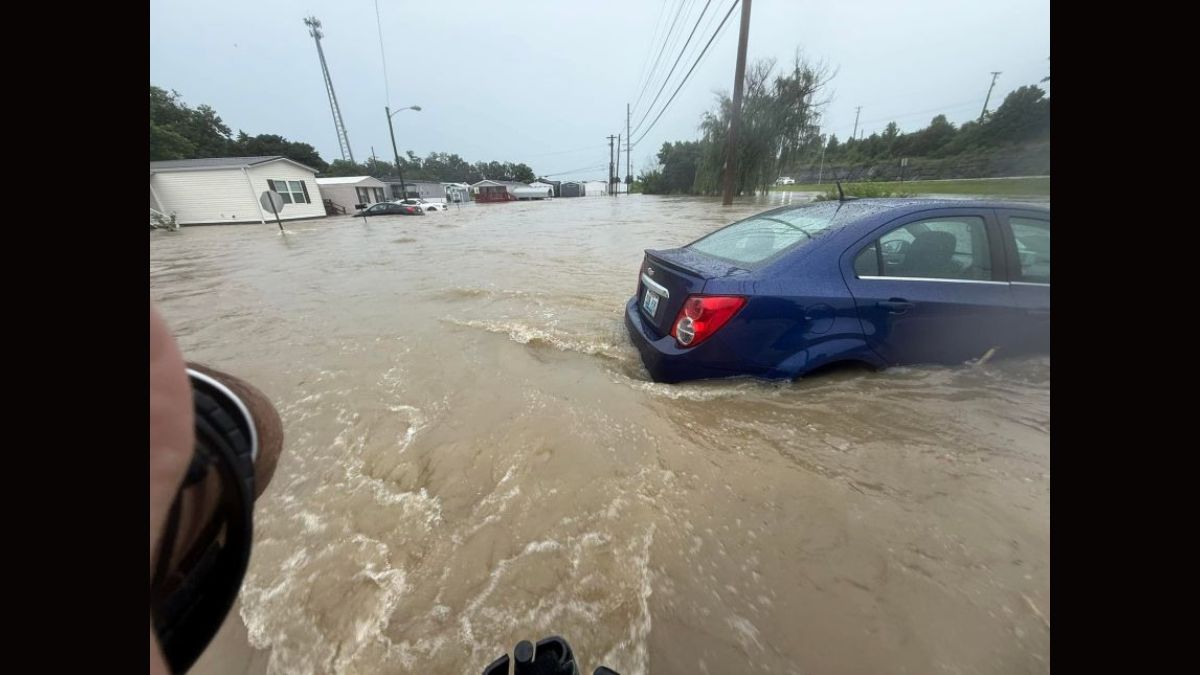
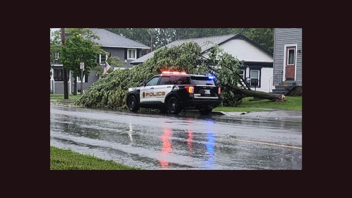
The damage from the storms was significant. On State Route 26 in the town of Denmark, Lori Atkinson said she was nearly swept off her feet by the wind as she rushed to close her garage door. She lost three large trees, one of which crushed her pool while another narrowly missed her grandchildren’s swing set.
The National Grid outage map showed hundreds of customers without power at the height of the storm, with the heaviest impacts reported in the Cape Vincent, Chaumont, and Lorraine areas.
By Tuesday night, the National Weather Service lifted its severe thunderstorm warning but issued a severe thunderstorm watch, extending the threat of dangerous weather until 8 p.m. Residents were urged to stay alert as forecasters continued monitoring the region for additional storm development.